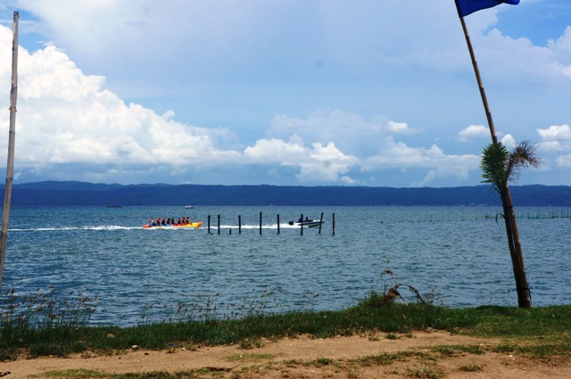
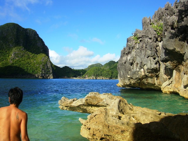
Mountains in Bicol Region

The Bicol region was one of the first five provinces I saw during the early days of my travel. But because most of it was because of work, there was only one time where I got to see beautiful places in the region. The first destination I saw was the strong waves of Bagasbas Beach in Daet. I also visited Cagsawa Ruins and the Daraga Chuch. I went to Albay numerous times but every time I went there, the marvelous Mayon Volcano was covered with clouds.
I went to Bicol from the night bus or a plane from Naga or to Albay. The trip with my friend in Camarines Norte and Sur was by bus and because it was either we were sleeping or we were standing we didn’t see the amazing scenery along the roads. Until recently I traveled because of work again, but this time we went there by driving.
There are so many interesting mountains when you enter the Bicol Region. You can either enjoy it while on the road or when you are at your destination.

Bicol Nature Park and Mount Labo

There are four mountain ranges in Camarines Norte. They are Mount Bagacay, Mount Cadig, Mount Labo and Susong Dalaga Mountain. Mount Bagacay is a dormant mountain in Paracale town. On its peak is overlooking the Labo River that runs to the town of Vinzons. You can also see it from Calaguas Island.

Mount Labo is an active stratovolcano located in the town of Labo. Other mountains are part of the Bicol Natural Park which connects Camarines Norte – Basud and Mercedes and Camarines Sur – Sipocol and Lupi. The natural park is also known for the winding road called Bituka nang Manok. The Mountain of Susong Dalaga is also located in the park.

CamSur Mountains

Mount Isarog and Mount Iriga are both a stratovolcano. Mount Isarog covers the 6 municipalities in Camarines Sur.

Mount Iriga also is known as Mount Asog is a kilometer away from Lake Buhi.

Magayon Trio

There are three volcanic mountains in Albay called Magayon Trio – Mount Masaraga, Mount Malinao and Mount Mayon.

Mount Masaraga is found in the municipalities of Ligao City, and Mount Malinao is between Ligao city and Tiwi. The Tiwi Geothermal Plant is located in the mountain of Mount Malinao. The beautiful perfect coned shape Mayon Volcano is visible in the municipality of Guinobatan in Albay.

Sorsogon Mountains

Mount Bulusan is the most active and prominent volcano in Sorsogon. Connecting Albay to Sorsogon are the mountains called Pocdol Mountain also known as the Bacon – Manito Volcanic Belt and Mount Pulog.
Mount Bintacan, Mount Batuan Mount Culangalan, Mount Caloomutan, Mount Homahan, Mount Jormaqam, Sharp Peak and Gate Mountains are concentrated near Mount Bulusan.

All the mountains and volcanoes are visible while driving along the Pan-Pacific Highway.

Naga City in Camarines Sur

Naga is in the center of the Bicol Region and located in Camarines Sur. The City of Naga is also known as the Pilgrim City. It is the largest destination of the Marian pilgrimage in Asia because of the devotees of the Our Lady of Peñafrancia.
The city is also the seat of the Roman Catholic Archdiocese of Caceres. The dominant Catholic religion is supported by different historical and influential institutions. There are so many churches run by different religious institutes like Our Lady of Peñafrancia, Peñafrancia Basilica De Minore, Ateneo de Naga University, University de Santa Isabel, University of Nueva Caceres, Naga Metropolitan Cathedral and San Francisco Church.

Porta Mariae

The Porta Mariae or Marian Gate is located at Barlin Street with a neoclassical architectural style. It stands as a symbol of the Bicolano’s devotion to the Blessed Virgin Mary under the title of Nuestra Señora de Peñafrancia. It adds beauty to the historical church of Naga Metropolitan Cathedral.

Naga Metropolitan Cathedral

It is the oldest standing cathedral in Luzon which was established in 1595. It is also known as the Metropolitan Cathedral of Saint John the Evangelist. The architecture of the building is Baroque-Romanesque and stands near the different universities in Naga.

Our Lady of Peñafrancia Shrine

Our Lady of Peñafrancia Shrine is a baroque church under the jurisdiction of the Archdiocese of Caceres. It was the home of the image of Our Lady of Peñafrancia before it was transferred to Peñafrancia Basilica. It is where the Translacion procession of the Our Lady of Peñafrancia starts which is the signal of the Peñafrancia Festival.

Peñafrancia Basilica De Minore

The Peñafrancia Minor Basilica is the only Basilica in the Bicol Region which was constructed in 1976. It was opened in 1982 in honor of The Church of Nuestra Señora de Peñafrancia. The image of the Virgin Mary sculpted in 1710 is located here.

San Francisco Parish

San Francisco Church was established in 1578 and built by Franciscan Friars. It is located along the busy street of Peñafrancia Street surrounded by malls, restaurants, hotels, and banks. It also near the El Pueblo de Camarines Sur a Sus Quince Martires del 96, a historical landmark for the Katipuneros.

Naga City also has the Naga Airport and as the heart of Camarines Sur, it also the jump-off point of going to the famous Caramoan and other municipalities surrounding Mount Isarog.

Sta Rita Island, Del Gallego, Camarines Sur

Sta. Rita Island is located at Del Gallego, Camarines Sur. It has the longest infinity in Camarines Sur.

How to get to Sta Rita Island

The following day we were supposed to meet at 7AM but we all made it at 9AM, where all of us were heading to Sta Rita Island to swim. It was a two hours ride from Calauag to Sta Rita, but we first check the resort in Tagkawayan called Villa Aeesa but we decided to head to Sta. Rita Island which was our first plan. From the resort, it was a 20 minutes ride more along the highway and another 3 km ride in uneven terrain. A service vehicle is a must since there is no public transportation available going to the resort.


They said Sta Rita island used to be an island where you need to ride a boat for a 10 minutes ride, but they put a man-made pathway to extend the island to the main town of Del Gallego. The entrance for the beach is 50 pesos and the entrance to the infinity pool is 150 pesos. We also rented a nipa hut worth 500 pesos where we stayed. There are sports activities on the island like banana boat and jet ski.

Exploring Sta Rita Island

We were very hungry although it was only past 10 AM. We ate lunch which was prepared by our main cook Eunice. We set up a tent just in case someone needed to sleep while we put all our bags in there. After eating we started to drink Emperador. By past 12 in the afternoon we then tried swimming at the beach.

But the water was murky so we decided to go to the infinity pool where we stayed for a while, had our photo shoot at a different angle. It is the longest infinity pool in Camarines Sur.


It was 3 in the afternoon when we went inside the pool again and trekked the grotto. It was a stairway going up with to the highest spot of the resort where there is a veranda or view deck that will let you see the whole place on top 360 degrees. You will see the hills and mountains of Bicol.


From the top, we also saw that it was already low tide and the sand bars near our nipa hut was located was already visible.

We then went down to check out the small L-shaped sandbar. We spent the rest of the afternoon on the beach front, taking pictures and waiting for the sunset.

For more information about Camarines Sur, please check the post: Caramoan, Camarines Sur

Pearl Watch

Book Your Vatican Museums Tickets – Italy’s Most Popular Attraction

Caramoan, Camarines Sur

The Caramoan peninsula is located at the eastern portion of Camarines Sur in front of Catanduanes.  It is the home of so many islands and islets and the scenic view of towering cliffs and lush green mountains with the perfect sunrise.

This was my 2nd Quezon – Bicol trip with Cam. Cam already resided in Calauag after a year when we went to Gumaca, Quezon

Mountain range in Lagunoy Gulf

We travel for 4 hours by bus from Calauag to Naga City.  From the terminal in Naga City, we rode a van to take us to Sabang Port in San Jose, Camarines Sur.  We took a boat and traversed the mountain ranges and the Lagonoy Gulf. After almost two hours we reached the port of Guijalo.

Upon reaching the port, we rode a motorcycle where we asked the driver to take us to a resort but he told us it because it was summer, the resorts were fully booked, so he suggested and bought us to the town where we stayed with the locals and rented a room for an overnight stay.

It was a long journey, so we went out at night and found a restaurant along the Paniman beach and had our dinner.  We went to and talked to the owner about Caramoan.  After which we stayed outside enjoying the beach until it was almost midnight.

The following morning we were referred to a boatman and toured us in the island.  We were welcomed by the perfect sunrise of Caramoan.  The first stopped was Minalahos island. An island in front of Gota Beach which is good for swimming. There’s also a table rock in front, a point of jump-off for diving.

Minalahos Island

Gota Beach was the resort where the crew and staff of Survivor stayed.

Gota Beach

Then we went to Hunongan Cove with a view of longer sandbar and coconut trees at the beach front.


Kagbalinad island is the front view of Hunongan Cove.

Kagbalinad Island

Going to Caramoan had been a challenge, and 2 days wasn’t enough to explore the islands.  We went there during those times the Survivor series was being shot in the different islands.  Most islands were being used for production. The tourists and locals were restricted on some island like the Gota Beach.

Because of time constraint, we weren’t able to explore the islands but we promised to go back to Caramoan for a longer stay. Other notable islands are Matukad, Lahus, Cotivas Island, Sabitayang Laya and many other islands.

Pearl Watch

Guaranteed Access to Tickets for Leonardo da Vinci’s Last Supper and Milan Museums and Attractions!